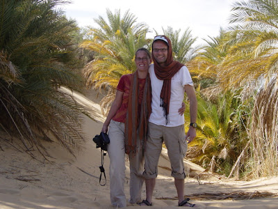
Saturday, January 12, 2008
Camping in the dunes
Believe it or not, this weekend in January was the first time this season we went to the desert. Apparently, we were to busy in the autumn with work, travel to Somalia and offshore and windsurfing at Moon Beach.
We wanted to find a new route from the escarpments north of lake Qarun to the Wadi el Hitan area and to traverse the dune belt south of the Wadi Ryan lakes West to East.
The first leg of the route went fast. We followed tire tracks that we spotted before on the satellite images. When we came at the top of the final escarpment we had a beautiful view. It was pretty windy and cold at the top, and this was midday. We expected a cold night.
But finding the way down was not easy. We tried several wadis, but most of them were a dead end. In one wadi, a dune had made the route down easier. We also saw tracks of people that tried before. The tricky part was that you had to decent a steep dune, but you could not drive straight on as you would hit the large rocks on the wadi floor. After a controlled descent you would have to made a sharp right and drive out of the wadi along a narrow passage between the large rocks and the dune. But it looked doable.
Ramses was the first to try.
The drive to the dune crest was easy, just a little slippery at the sharp turns in the sand. We turned down slope a bit too early and we headed straight for some rocks on the slope. Steering on the slope was difficult and we drove straight over the rocks. Fortunately they turned out to be pretty small when we came closer. We still had to make the sharp turn to avoid the big rocks. Once we stopped using the brake technique, we could steer again and we made it through the narrow passage without a problem. But we decided the route was probably better to avoid by the other three cars. We waited at the bottom of the valley for the other three cars that found pretty quickly a much easier route.
All the escarpment business had taken a lot of time and we decided to head straight for the Wadi Ryan road to be in the dunes before dark. We found a nice secluded camping spot in the dunes.
We pitched our tents before dark and got a fire going. The wind had gone completely and it was not as cold as we were expecting. We sat around the campfire till 11 sipping Siwan tea and wine.
The next day we had a relaxing morning with a big breakfast of bacon, eggs and pancakes. Today we were going to do our traverse. We had let pressure of the tires and were ready to go.
We got several cars stuck at dune crests and soft patches and we made good use of the low gears, towropes, sand plates, shovels, and the air jack. Good fun playing in the sand.
At lunchtime we realized we did only 1/4 of the planned route. It was quite windy and we had sand everywhere. Fortunately, after lunch dunes became easier, or our driving better or both and we finished the traverse to be back on the tarmac road at 3pm. Just in time to make it to Cairo before dark.
Back home we noticed that sand kept coming out of our eyes for 2 days after we returned. But we are sand-free now… I think.
More on this in Ivar & Kim's blog (in Dutch).
Wednesday, January 02, 2008
Akhenaton
Our favorite pharaoh is probably the 18th dynasty Akhenaton, who ruled 1364-1347 BC. Maybe it is because we already knew him before we came to Egypt from Philip Glass’ best opera with the same name. Maybe it is because he was the pharaoh that started a new monotheistic religion worshipping only the sun god Aten. Maybe it is because the Egyptian art from the period he lived became very distinct with humans figures with exaggerated features, often very feminine. Or maybe it is because of the mystery surrounding him, his wife Nefertiti and his son Tutankhamen, the young pharaoh.
Akhenaton started as Amenhotep IV and changed his name to Akhenaton when he started the religion of the Aten. He also transferred the capital of Egypt from Thebes to Amarna. This is how he tried to stop the influence of the powerful priests of Thebes. He only ruled for 16 years followed but only 2 years (?) of his wife Nefertiti and his son Tutankhamen, by a minor wife, ruled for 9 years as the 11th king of the 18th dynasty. Under Tutankhamen the religious transition was reversed, the old temples were reopened and Egypt’s fortunes were restored after the disaster of his father's reign.
Much of Akhenaton’s legacy was destroyed and erased. Many ancient pharaoh lists and historic accounts omit Akhenaton and the Amarna period completely. His name is often erased from buildings or overwritten with the name of a later pharaoh. This is why Akhenaton is surrounded with mystery and much of the art from this period is lost.
The interesting aspect of the art in the Amarna period is that it is radically different from the “classic” Egyptian style of art of the periods before and after the Amarna period. Statues and murals exaggerate human features and feminine forms. Typical are the big skulls, fat lips, wide hips and often a belly. The exaggerated feminine forms, displayed on both male and female figures, and equally on figures of Akhenaton himself inspired some controversial speculation that Akhenaton could be gay.
Amarna style statues with feminine forms
Before we visited Tell al Amarna we had already seen some of this Amarna style art at the tombs of the Nobles on the west bank of Luxor a few days before on December 29th. The tomb of Ramose, who was a governor under Amenhotep III and Akhenaton, showed some of the typical Amarna style sun god murals. Where the sun (god) is displayed with sunrays with little hands at the end of the ray. Ramose's tomb at Thebes was never finished as he decided to follow Akhenaton to Tell al Amarna.
Entrance to Tomb of Ramose
The Luxor museum also boasts impressive Amarna art. There is an enormous wall made of sandstone blocks, named talatat or threes (probably because their height and length was abound 3 hand lengths), with scenes from the Amarna period. About 40,000 of these blocks where only found in the sixties as a filler inside the 9th Pylon of Karnak. It shows how everything was done in the periods after Akhenaton to erase his legacy. The partially reassembled wall shows Akhenaton and his wife Nefertiti and scenes of temple life in the typical Amarna style.
Part of a wall from the Temple of Akhenaten at KarnakRemoved from the interior of the Ninth Pylon where the blocks or 'talatat' had been used as rubble core
(Luxor Museum)
Tell al Amarna is the area where Akhenaton started the new city of Akhetaten (Horizon of the Aten), which served as Egypt's capital for 14 years. It is situated in a wadi plain on the east bank of the Nile. The once glorious city of palaces, temples and residences was completely surrounded by a high cliff in the east and the Nile in the west. The buildings are now largely destroyed, but the necropolis of 25 tombs hewn in the Cliffside is still there.
Not all tombs are open to the public. We visited 8 tombs, and we where not allowed to take pictures inside. We started with the royal tomb of Akhenaton himself 13 km into the Wadi Darb al Malek (Arabic for valley of the king’s road) that cuts into the cliff. This was the most remote tomb.
Many of the murals show the sun (Aten) with sunrays with little hands on the end that hold the Ankh, sign of life, or the sign of power.
We went to see the 6 northern tombs; the tombs of Huya, Meryre II, Ahmose, Meryre I, Panahesy and Mahu. Near the northern tombs we also saw one of the 14 large stone stelae that marked the boundary of the royal city.
In the southern necropolis we saw the tomb of Ay. Ay’s title was fan-bearer on the king’s right hand and he was never buried here. He became a pharaoh after Tutankhamen and was buried in the west valley beside the Valley of the Kings at Thebes.
Thursday, December 27, 2007
Mons Claudianus
On our way from Al Gouna to Luxor we had to join the compulsory convoy with police escort at 9 am at the Safaga checkpoint. We tried in our best Arabic to convince the police that we could drive to Luxor alone, but they did not give in. Them we asked them if we could see Mons Claudianus, a famous mountain with a Roman quarry and fortress complex, about 15 km off road in the Eastern desert. The police was very accommodating and we got the permission, we only had to take a police agent in the car for when we would leave the convoy. We are normally not very keen on having police in your car, but we really liked to see Mons Claudianus and we found it difficult to refuse.
The mountains around Mons Claudianus on Google Earth. The red line in the bottom right is the Safaga to Qena road. The line from the bottom right to the upper left is our off road track to Mons Claudianus.
We drove off with the convoy and we left the road after about 40 km. At a small roadside cafe we picked up a local guide to show us the way. It was not that easy to find, so we were glad we had our guide.
At the side, there was a fortress and the desert floor was full off broken pottery and pieces of quarried granite. You still could see many pieces with the original holes for the wooden wedges. Romans and Egyptian used a technique where they would hammer wooden wedges in a row of small holes they cut in the rock. By poring water on the wedges the wood would expand and break the rock. We had seen similar holes at the quarry of the broken Obelisk in Aswan.
The landscape here is beautiful, but very remote and desolate. Roman prisoners were used to hack the granite out of the mountains and it was a hardship post for the Roman soldiers who guarded them. The enormous granite blocks and pillars quarried here were transported over 180 km of desert and mountains to Qena, where they were put on boats and shipped to Rome and other places. The walls of the fortress and houses of the complex were made up of irregular pieces of granite that where probably not good enough to be shipped to Rome.
A short car drive further we saw an enormous broken pillar, probably left where it was broken 2000 years ago.
Our guide showed us some old water wells where Bedouins were filling up their water tanks, after which he led us back to the main Safaga-Qena road. We dropped him at the cafe and continued our journey to the Nile. We had a tea and lunch break with our police officer at a small roadside cafe just before the checkpoint about half way between Safaga and Qena. When we continued our journey our police officer asked us to drop him off at the checkpoint and we could continue our drive to Luxor alone. We were very happy, but we still do not understand why the convoy is compulsory for foreigners if this police agent let us off so easily. Anyway, we had our freedom back for the rest of the day!
On the way we saw many mini buses with ornamental leaves on their roof rack, sometimes combined with white flags and big loudspeakers. We learned later that these buses were returning pilgrims from the Haj. The pilgrims take the boat back from Jeddah to Safaga, and then continue their journey with buses across the eastern desert. We had never seen this in Cairo around the time of the Haj. Apparently, it is tradition in Upper Egypt to recite Quran verses through the loudspeakers and to carry the leaves and white flags.
The mountains around Mons Claudianus on Google Earth. The red line in the bottom right is the Safaga to Qena road. The line from the bottom right to the upper left is our off road track to Mons Claudianus.We drove off with the convoy and we left the road after about 40 km. At a small roadside cafe we picked up a local guide to show us the way. It was not that easy to find, so we were glad we had our guide.
At the side, there was a fortress and the desert floor was full off broken pottery and pieces of quarried granite. You still could see many pieces with the original holes for the wooden wedges. Romans and Egyptian used a technique where they would hammer wooden wedges in a row of small holes they cut in the rock. By poring water on the wedges the wood would expand and break the rock. We had seen similar holes at the quarry of the broken Obelisk in Aswan.
The landscape here is beautiful, but very remote and desolate. Roman prisoners were used to hack the granite out of the mountains and it was a hardship post for the Roman soldiers who guarded them. The enormous granite blocks and pillars quarried here were transported over 180 km of desert and mountains to Qena, where they were put on boats and shipped to Rome and other places. The walls of the fortress and houses of the complex were made up of irregular pieces of granite that where probably not good enough to be shipped to Rome.
A short car drive further we saw an enormous broken pillar, probably left where it was broken 2000 years ago.
Our guide showed us some old water wells where Bedouins were filling up their water tanks, after which he led us back to the main Safaga-Qena road. We dropped him at the cafe and continued our journey to the Nile. We had a tea and lunch break with our police officer at a small roadside cafe just before the checkpoint about half way between Safaga and Qena. When we continued our journey our police officer asked us to drop him off at the checkpoint and we could continue our drive to Luxor alone. We were very happy, but we still do not understand why the convoy is compulsory for foreigners if this police agent let us off so easily. Anyway, we had our freedom back for the rest of the day!
On the way we saw many mini buses with ornamental leaves on their roof rack, sometimes combined with white flags and big loudspeakers. We learned later that these buses were returning pilgrims from the Haj. The pilgrims take the boat back from Jeddah to Safaga, and then continue their journey with buses across the eastern desert. We had never seen this in Cairo around the time of the Haj. Apparently, it is tradition in Upper Egypt to recite Quran verses through the loudspeakers and to carry the leaves and white flags.
Friday, December 21, 2007
Qalaat al Gindi
Towards the end of the year it turned out that Jurriaan's work offshore had progressed better than expected and that we could take a few weeks holiday around Eid al Adha, Christmas and New Year. We decided to start with five days surfing at Moon Beach, followed by Christmas at Al Gouna, New Year in Luxor, and driving back to Cairo along the Nile. More on the rest of this trip later.
We borrowed wet suits from friends, as it can get a bit nippy in the Gulf of Suez in December. One day the weather was bad for beach and surfing: no wind, no sun and the occasional drizzle, so we decided to explore the Sinai. We went to Qalaat al Gindi, the ruins of the 12th century Fortress of Salah ad-Din or Saladin, built in strategic location where three caravan routes converge. The fortress was originally built to protect pilgrims making their haj from Africa to Mecca and trade caravans from Africa to Asia. Saladin had planned to use the fortress as a base to launch attacks on the crusaders who had reached Jerusalem at the time. However, Saladin managed to chase the crusaders out of Jerusalem before the fortress was finished.
Qalaat al Gindi on Google Earth

We walked around the outer walls to get a good feel for the scale of the complex.
We borrowed wet suits from friends, as it can get a bit nippy in the Gulf of Suez in December. One day the weather was bad for beach and surfing: no wind, no sun and the occasional drizzle, so we decided to explore the Sinai. We went to Qalaat al Gindi, the ruins of the 12th century Fortress of Salah ad-Din or Saladin, built in strategic location where three caravan routes converge. The fortress was originally built to protect pilgrims making their haj from Africa to Mecca and trade caravans from Africa to Asia. Saladin had planned to use the fortress as a base to launch attacks on the crusaders who had reached Jerusalem at the time. However, Saladin managed to chase the crusaders out of Jerusalem before the fortress was finished.
Qalaat al Gindi on Google EarthWe knew about it through a website of a colleague, who had left Egypt before we arrived. This is actually the second attempt to go to Qalaat al Gindi. In February 2007 we went also, but is was rainy and the paths were too slippery to go up safely. This time it was dry (only just), and we climbed up the steep route (bottom middle on the Google Earth picture).
When we reached the top of the plateau there were more ruins to see than we expected. We saw some old Arabic texts cut in rock.
old Arabic text above a window arch
Even though it was not such a clear day we had beautiful views all around from this strategic location. Most of the walls and some large vaulted rooms are still standing.We walked around the outer walls to get a good feel for the scale of the complex.
Wednesday, October 17, 2007
Howling wind at the Gulf of Suez
During the Eid al Fitr holiday (end of Ramadan) we went three days to Moon Beach. The wind was really strong, but after a full season of practice we can now surf with a harness in this wind! We are regular guests now at the moon beach surf centre.


Jurriaan on the plane


Jurriaan off the plane (and the board!)
Windsurfing is really exciting in this wind and we hope to go at least one more weekend before the winter season starts. We still have not mastered waterstarting. We took a lesson and we made progress - even an occasional lucky succesfull attempt -, but we need a lot more pratice!
Surfcentre
Corine on the plane
Jurriaan on the plane
Jurriaan off the plane (and the board!)
Corine off the plane (and the board!)
Windsurfing is really exciting in this wind and we hope to go at least one more weekend before the winter season starts. We still have not mastered waterstarting. We took a lesson and we made progress - even an occasional lucky succesfull attempt -, but we need a lot more pratice!
Wednesday, May 23, 2007
The view from our roof on El-Khartum Street
Tonight we took this picture. It was by chance. Our satellite reception had broken down a couple of weeks ago, and Farouk and Samir were trying to repair this. The dish is on the roof and there Farouk showed us proudly "his" madrassa (the French school opposite our house, where he works) as well as the view to the mosque near us (to the right and in front) and "Qasr El-Baron" or Baron Palace (left in the back).
Baron Palace was the former residence of Baron Empain, the man who "built" Heliopolis, in the beginning of last century. It was built in 1910 and resembles the Cambodian temples of Angkor Wat. With the celebration of 100 years Heliopolis, it was open to the public for one month. The land beside it is turned into a garden and at night the Palace is beautifully lit. We visited it in the month that it was open to the public last year. All built in concrete, it does have its charm and forms a special landmark.
We soon will post some pics of the villa (and neighbourhood) we are so lucky to live in while we are in Egypt. It was built in 1927 in Baron Empain "style" and we are near the old centre of Heliopolis, called Korba.
Baron Palace was the former residence of Baron Empain, the man who "built" Heliopolis, in the beginning of last century. It was built in 1910 and resembles the Cambodian temples of Angkor Wat. With the celebration of 100 years Heliopolis, it was open to the public for one month. The land beside it is turned into a garden and at night the Palace is beautifully lit. We visited it in the month that it was open to the public last year. All built in concrete, it does have its charm and forms a special landmark.
We soon will post some pics of the villa (and neighbourhood) we are so lucky to live in while we are in Egypt. It was built in 1927 in Baron Empain "style" and we are near the old centre of Heliopolis, called Korba.
Friday, May 18, 2007
Dune driving with Hein and Noel
Last weekend we went to the desert around Fayoum, to camp at out most favourite campsite at an oasis in a beautiful dune field. Hein en Noel are visiting us from the US and indicated that they liked our desert camping proposal. So this was a good opportunity for Ramses (our Landrover) to show them a bit of Egyptian desert. Paul, Petra, Fenna and David joined us in their Prado.
Sunset in the dune near our campsite (left to right Jurriaan, Corine, Hein & Noel)
Wild Scorpion
Sunset in the dune near our campsite (left to right Jurriaan, Corine, Hein & Noel)On the second day weather turned out to be very hot (46C!) and windy, so it is like having 10 hairdryers at maximum power around you when you walk outside. Luckily we did not get stuck in the sand so severily that a lot of digging was involved, so most of the time we could stay in the shade of our car. On the way we saw a WWII petrol can, and when we lifted it from the sand we saw our first wild scorpion in Egypt.
We will post more pictures soon. Paul and Petra have put a nice collection of pictures on their website already.
Tuesday, May 15, 2007
Felucca
On Hein and Noel's second day in Cairo we organised to sail on the Nile at sunset with a group of friends. Traffic was remarkably quiet, so we arrived early at the jetty in Ma'aadi. No matter how busy, noisy or polluted it is in Cairo, as soon as you sail on the Nile the atmosphere becomes tranquil and relaxing...
Saturday, May 05, 2007
Moonbeach
Already our third weekend at moonbeach this season. We met several of our moonbeach friends: Mike, Adina, Thor, John. The previous weekend we had no wind. This weekend we had too much wind for us beginner windsurfers. But the experienced surfers were very happy. So instead we snorkeled, read books, celebrated Mike's birthday and took spectacular photo's of the advanced windsurfers.
Thursday, April 26, 2007
A short trip to Dahab in the Sinai
Wednesday 25 April is Sinai Day in Egypt, a bank holiday. So we decided to take the Thursday off as well and go to the Sinai for a long weekend. It is more than a year ago we were in Dahab for the last time (before the bombing of 24 April 2006, when 22 people died in a terrorist attack). There are two dives we liked to do in Dahab that we had on our list for a while, which had not happened yet: The Canyon and The Blue hole. Moreover, we wanted to visit the Coloured Canyon, a famous site in the Sinai desert.
The reason we do not go so often to Dahab is that it is a long drive (about 6-7 hours). Previous time we drove though the southern tip of the Sinai via Sharm el Sheikh or via Saint Catherine. This time we decided to try to faster northern route via Taba, close to the Israeli border.
We arrived in time to watch the sunset from our hotel balcony with a chilled glass of white wine. A good start of the holiday!
The next day we wanted to buy fins to complete our snorkel gear, get signed in at the dive centre and get the dive equipment fitted for tomorrow and do some snorkeling with our underwater camera!

The site where we snorkeled was recommended to us by two dive centres. It is called the Islands, because of the coral pinnacles. Just when we got in, still swimming above the reef we were greeted by a beautiful purple jellyfish.
We continued towards the reef drop-off where a masked pufferfish swam up through the cracks. We were happy with our new fins, that had more propulsion power than the rental fins we usually have.
We swam over one of the pinnacle reefs, but closer to the deep water the temperature became a bit chilly. Just in front of us three cornetfishes passed.
We started to swim back to warm up and close to the reef edge, a beautiful lionfish swam underneath us.
The next day we met our dive guide early we thought. But Egyptian summer time started for the first day, and this had taken our guide by surprise. So we left late to the Canyon. At the site it turned out that we arrived passed the rush hour as many dive groups from Sharm where just coming out of the water. So we had the canyon for ourselves (we had to wait a few minutes at the entrance at about 20m depth, until all divers had left. We descended down to 30m metres and enjoyed how hundreds off dusky sweepers (a cave fish) where circling around us. From there we swam out though a narrow tunnel to the edge of the reef table to continue the shallow part of the dive along the reef. We saw a lot of of reef life, but we did not take the camera this time.
We had lunch at the Blue Hole, while we were waiting till the dive groups from Sharm finished. The Blue Hole is a very deep (110m) circular hole in the reef. Our dive started north of this hole at “the Bells” where we descended through a crack in the reef and swam out through an arch at 26m. We swam along the reef south while slowly ascending to the saddle at 7m that leads to the Blue Hole. On the way a big school of Fusiliers, with black-tipped fins, passed us. Thoughout the dive we had to watch our depth meters as there was no bottom below us. The Blue Hole is infamous for this, and quite a few divers have died here when they tried to go too deep, or when they panicked from not seeing a bottom.
The reason we do not go so often to Dahab is that it is a long drive (about 6-7 hours). Previous time we drove though the southern tip of the Sinai via Sharm el Sheikh or via Saint Catherine. This time we decided to try to faster northern route via Taba, close to the Israeli border.
We arrived in time to watch the sunset from our hotel balcony with a chilled glass of white wine. A good start of the holiday!
The next day we wanted to buy fins to complete our snorkel gear, get signed in at the dive centre and get the dive equipment fitted for tomorrow and do some snorkeling with our underwater camera!
We continued towards the reef drop-off where a masked pufferfish swam up through the cracks. We were happy with our new fins, that had more propulsion power than the rental fins we usually have.
We swam over one of the pinnacle reefs, but closer to the deep water the temperature became a bit chilly. Just in front of us three cornetfishes passed.
We started to swim back to warm up and close to the reef edge, a beautiful lionfish swam underneath us.
The next day we met our dive guide early we thought. But Egyptian summer time started for the first day, and this had taken our guide by surprise. So we left late to the Canyon. At the site it turned out that we arrived passed the rush hour as many dive groups from Sharm where just coming out of the water. So we had the canyon for ourselves (we had to wait a few minutes at the entrance at about 20m depth, until all divers had left. We descended down to 30m metres and enjoyed how hundreds off dusky sweepers (a cave fish) where circling around us. From there we swam out though a narrow tunnel to the edge of the reef table to continue the shallow part of the dive along the reef. We saw a lot of of reef life, but we did not take the camera this time.
We had lunch at the Blue Hole, while we were waiting till the dive groups from Sharm finished. The Blue Hole is a very deep (110m) circular hole in the reef. Our dive started north of this hole at “the Bells” where we descended through a crack in the reef and swam out through an arch at 26m. We swam along the reef south while slowly ascending to the saddle at 7m that leads to the Blue Hole. On the way a big school of Fusiliers, with black-tipped fins, passed us. Thoughout the dive we had to watch our depth meters as there was no bottom below us. The Blue Hole is infamous for this, and quite a few divers have died here when they tried to go too deep, or when they panicked from not seeing a bottom.
Subscribe to:
Posts (Atom)